Embarking on the Everest Base Camp trek is a remarkable adventure, and having a comprehensive Everest Base Camp trek map is essential for a successful trip.
The trek begins after a thrilling 35-minute flight to Lukla, the gateway to the Everest trek, with an altitude of 2,860 meters. From there, trekkers head to Phakding at 2,610 meters, ideal for initial acclimatization, followed by Namche Bazaar, a bustling market town at 3,440 meters.
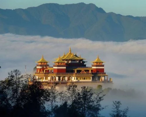
From here, the route leads to Tengboche, known for its stunning Tenboche monastery and panoramic views at 3,867 meters, and Dingboche, a beautiful acclimatization spot at 4,410 meters.
Next is Lobuche at 4,935 meters, a crucial rest point before the final ascent. The trek continues to Gorak Shep at 5,164 meters, the last stop before reaching the ultimate destination, Everest Base Camp, at 5,364 meters.
The EBC trek map helps with navigation, planning daily stages, ensuring safety by monitoring altitude changes, and highlighting key points like water sources and emergency shelters.
Heading to EBC
Why is the map important for Everest Base Camp?
The Everest Base Camp trek is a thrilling adventure, and having a comprehensive Everest Base Camp trek map is crucial for several reasons:
Navigation
A detailed EBC trek map ensures you stay on the correct path throughout your journey.
The trails in the Everest region can be complex, with various junctions and side paths.
A map helps you navigate these routes accurately, preventing you from getting lost and ensuring you reach your daily destinations efficiently.
It provides a clear overview of the trek, indicating key locations, distances between stops, and the terrain you'll encounter.
This allows you to make informed decisions about your route and manage your time effectively.
Planning
Planning is essential for a successful trek. An Everest Base Camp map assists in organizing your daily stages, including where to stop for rest and acclimatization.
It allows you to estimate the distance and time required for each segment of the trek, helping you to manage your energy levels and prepare for the day's challenges.
Detailed maps often include information about altitude profiles, which is vital for planning acclimatization days to prevent altitude sickness.
Knowing the layout of the route enables you to arrange accommodations and food in EBC and logistics well in advance, ensuring a smoother trekking experience.
Safety
Safety is paramount on any trek, especially in high-altitude regions like Everest.
A detailed map provides information about altitude changes, potential hazards, and emergency shelters.
By monitoring your altitude and knowing where emergency facilities are located, you can better manage the risk of altitude sickness and other potential dangers.
Maps can highlight critical areas such as steep ascents, river crossings, and avalanche-prone zones, allowing you to take necessary precautions.
They also show the locations of medical facilities, evacuation points, and communication centres, ensuring you have access to help if needed.
Inspiration
An EBC trek map also serves as a source of inspiration. It highlights scenic spots, cultural landmarks, and significant points of interest along the way.
Knowing where these highlights are can motivate you and enrich your trekking experience, making your journey even more memorable.
Points of interest, such as the Tengboche Monastery, panoramic views from various vantage points, and the iconic Everest Base Camp itself are often marked on maps.
This allows you to look forward to these experiences, enhancing your overall adventure.
Everest Base Camp Trek Map
Day-by-Day EBC Trek route
A day-by-day route map for the EBC trek will help you navigate and plan your journey more effectively. Here's a standard 14 day itinerary to guide you through each stage of the trek:
Day 1: Arrival in Kathmandu (1,400 meters)
Day 2: Flight to Lukla and Trek to Phakding (Lukla 2,860 meters and Phakding 2,610 meters)
Day 3: Trek from Phakding to Namche Bazaar (Namche Bazaar 3,440 meters)
Day 4: Acclimatization Day in Namche Bazaar
Day 5: Hike from Namche Bazaar to Tengboche (Tengboche 3,867 meters)
Day 6: Trek from Tengboche to Dingboche (Dingboche 4,410 meters)
Day 7: Acclimatization Day in Dingboche
Day 8: Trek from Dingboche to Lobuche (Lobuche 4,940 meters)
Day 9: Hike from Lobuche to Gorak Shep and Everest Base Camp (Gorak Shep 5,164 meters and EBC 5,364 meters)
Day 10: Hike to Kala Patthar and Return to Pheriche (Kala Patthar 5,545 meters and Pheriche 4,371 meters)
Day 11: Trek to Namche Bazaar from Pheriche
Day 12: Return from Namche Bazaar to Lukla
Day 13–14: Flight from Lukla to Kathmandu and Departure.
Tips for Using the EBC Trek Route Map
Navigating the Everest Base Camp trek with the help of a detailed map can make your journey smoother and more enjoyable. The following are some essential tips for using the EBC trek route map effectively:
Study the Route Before You Start: Spend time studying the map before you begin your trek and mark key locations such as villages, rest stops, acclimatization points, and scenic spots.
Plan Your Daily Stages: Plan where you will start and end each day and identify where you will stay each night, whether in teahouses, lodges, or camping sites.
Monitor Altitude Changes: This helps in managing the risk of altitude sickness.
Mark Emergency Points: Note the locations of emergency shelters, medical facilities, and evacuation routes. Identify villages or stops where you can get local assistance in case of emergencies.
Track Your Progress: Check your position on the map at regular intervals to ensure you are on the right path.
Highlight Water Sources: Identify and mark water sources along the route. Ensure you know where you can refill your water supply.
Be Aware of Hazards: Mark areas with potential hazards such as steep ascents, river crossings, and avalanche-prone zones.
Keep a Backup: Carry a physical copy of the map and have a digital backup on your smartphone or GPS device.
Use a Compass or GPS: Use the compass or GPS to orient the map correctly and follow the marked trail.
Mistakes that trekkers make with Everest Base Camp trek map
Avoiding the following common mistakes with your Everest Base Camp trek map will help ensure a safer, more enjoyable, and well-organized trekking experience:
Not Studying the Map Beforehand
Overestimating Distances
Ignoring Altitude Changes
Missing Key Landmarks
Not Marking Emergency Points
Underestimating Terrain Difficulty
Forgetting Water Sources
Relying Solely on Digital Maps
Ignoring Local Updates
Not Using a Compass or GPS
Navigating the Everest Base Camp trek with the help of a detailed map can make your journey smoother and more enjoyable.
Beautiful Pheriche village in Everest Region
FAQs
Where can I find a reliable map for the Everest Base Camp trek?
Reliable Maps can be found at trekking gear shops in Kathmandu and Namche Bazaar. You can also use digital map apps like maps.me, Gaia GPS, and Google Maps offline.
Are digital maps reliable for the Everest Base Camp trek?
Yes, digital maps are reliable if downloaded for offline use before the trek. They provide GPS tracking and detailed route information but always carry a physical map as a backup.
What are the key landmarks to look for on the Everest Base Camp Trek?
The key landmarks include Lukla, Namche Bazaar, Tengboche Monastery, Dingboche, Lobuche, Gorak Shep, Everest Base Camp, and Kala Patthar.
How can I ensure I stay on the right path during the trek?
To ensure that you are on the right path during the trek, stay calm, retrace your steps to the last known point, and use your map and GPS to find the correct path. If you are unable to find the way, wait for other trekkers or seek help from locals.
Are there any alternative routes on the Everest Base Camp trek map?
Yes, there are alternative routes, such as the Gokyo Lakes route and the Three Passes trek. These routes offer different scenery and experiences but require additional planning and preparation.
How can I use the maps to identify acclimatization points?
The map shows key villages and points where trekkers typically rest and acclimatize, such as Namche Bazaar and Dingboche. Plan your stops based on these points to help prevent altitude sickness.
What are some common mistakes trekkers make with maps?
Some common mistakes include not familiarizing themselves with the map before the trek, failing to download digital maps for offline use, and not having a backup map. Always prepare thoroughly and check your route regularly.
For further details and information regarding the Everest Trips, feel free to reach out to Himalayan Recreation.


.webp)
.webp)